EARTH: HEALTH-HISTORY-Enigmas-Astronomy-UFOs-Science-AnimalsRead & Enjoy Many Interesting Articles in Here About our World -From the Past, Present & Future- Astronomy, Science and Technology, Archaeology, UFOs & Animals ..
Hallo to All Members. As you can see we regularly Upgrade our Servers, (Sorry for any Downtime during this).
We also have added more Forums to help you with many things and for you to enjoy.
We now need you to help us to keep this site up and running. This site works at a loss every month and
we appeal to you to donate what you can.
If you would like to help us, then please just send a message to any Member of Staff for info on how to do this,,,, & Thank You for Being Members of this site.
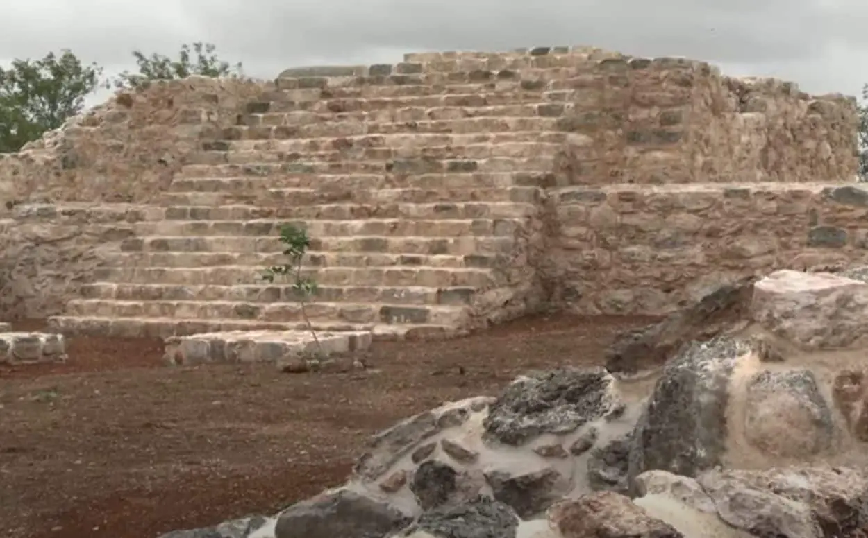
Lost Maya City With Temple Pyramids & Plazas Discovered in Mexico
Lost Maya City With Temple Pyramids and Plazas Discovered in Mexico
Archaeologists draw on laser mapping to find city they have named Valeriana, thought to have been founded pre-AD150
The Guardian 3 NOV 2024
The Maya ruins of Calakmul in Campeche, the same state where lidar has revealed further settlements.
After swapping machetes and binoculars for computer screens and laser mapping, a team of researchers have stumbled on a lost Maya city of temple pyramids, enclosed plazas and a reservoir, all of which had been hidden for centuries by the Mexican jungle.
The discovery in the south-eastern Mexican state of Campeche came about after Luke Auld-Thomas, an anthropologist at Northern Arizona University, began wondering whether non-archaeological uses of the state-of-the-art laser mapping known as lidar could help shed light on the Maya world.
?For the longest time, our sample of the Maya civilisation was a couple of hundred square kilometres total,? Auld-Thomas said. ?That sample was hard won by archaeologists who painstakingly walked over every square metre, hacking away at the vegetation with machetes, to see if they were standing on a pile of rocks that might have been someone?s home 1,500 years ago.?
Lidar is a remote sensing technique that uses a pulsed laser and other data obtained by flying over a site to generate three-dimensional information about the shape of surface characteristics.


:max_bytes(150000):strip_icc()/GettyImages-516220881-beb99bf881324965adaa6c0888f1b259.jpg)


 Linear Mode


